The Geomorphological Map of Lashio Town, Northern Shan State presents the spatial distribution of major terrain and landform characteristics. The map was prepared using Digital Elevation Model (DEM) data and GIS-based terrain analysis to identify and classify different geomorphological features. The analysis identifies terrain classes such as Flat areas, Peaks, Ridges, Shoulders, Spurs, Slopes, Hollows, Foot slopes, Valleys, and Depressions. These landform characteristics provide useful information for understanding the physical landscape and terrain patterns of Lashio Town. The resulting map can support urban planning, environmental assessment, watershed management, infrastructure planning, and natural hazard assessment, as well as provide a baseline for further GIS and Remote Sensing studies.
Request to Download High Resolution Map – https://drive.google.com/file/d/16PrR6Pf3G2IyUuItiagp1qzl3YcApZVy/view?usp=sharing
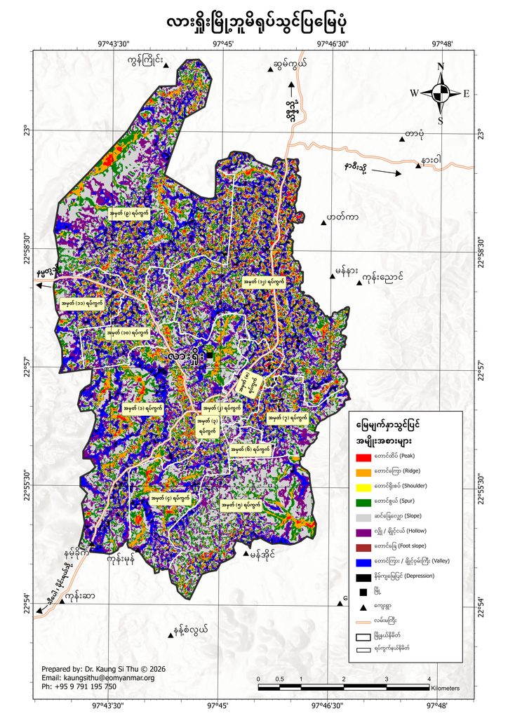
Kaung Si Thu. (2026). Geomorphological map of Lashio Town, Northern Shan State, Myanmar [Map]. GeoMap.

Naypyitaw Division,Oattara Thiri township
Geo map