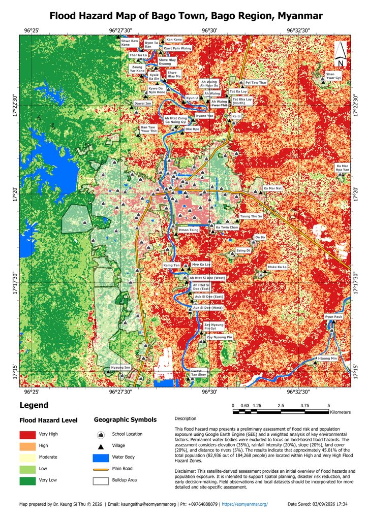
This map illustrates the spatial distribution of flood hazard across Bago Town, Bago Region, Myanmar, highlighting areas with different levels of flood hazard. The results provide useful information to support flood preparedness, land-use planning, disaster risk reduction, and sustainable development.
The flood hazard assessment was conducted using Google Earth Engine (GEE) and a weighted analysis of key environmental factors. Permanent water bodies were excluded to focus on land-based flood hazards. The analysis considered elevation (35%), rainfall intensity (20%), slope (20%), land cover (20%), and distance to rivers (5%).
The population exposure assessment indicates that approximately 45.01% of the total population (82,936 out of 184,268 people) are located within High and Very High Flood Hazard Zones.
Disclaimer: This satellite-derived assessment provides a preliminary overview of flood hazard and population exposure. The results are intended to support spatial planning, disaster risk reduction, and early decision-making and should not be considered a substitute for detailed field-based flood risk assessment. Local data, field observations, and historical flood information should be incorporated for more detailed and site-specific analysis.
Download High Resolution A3 Size — https://drive.google.com/file/d/1o3cDAACT_WLulY6JNt38TLQge9g-zaH3/view?usp=sharing